|
Information about Støtt Archipelago
Location
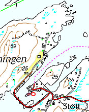
The village of Støtt is located in the eastern part of the Støtt Archipelago, concentrated around the sound between Svenningen and Inner Støtt, the two largest islands in this archipelago in Meløy Municipality adjacent to the Støtt Fjord, due southwest of the characteristic mountain of Kunna, which marks the beginning of the Helgeland Coast.
Description
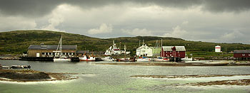
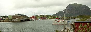
The general store and express boat / auto-ferry dock which are situated on an island in the middle of the sound, and the residential area are connected together via road-fill and jetty to the south that encloses the entire harbour basin. The population remains stabile, and there were 47 year-round residents in 2005. In this same year, however, the local school was closed due to a lack of pupils. But as of the winter of 2007, you will instead come across 400 to 500 reindeer out here owing to Støtt being situated within the Saltfjellet reindeer grazing district.
Access
You access this area by boat. Via either kayak or sailboat on a northern or southern route through this island community or via the express boat or auto-ferry.
Views/Sun/Climate
Støtt is located in the wide open and receives direct sunlight. Exposed to foul weather when the storms are at their worst, but a southern paradise on warm summer days. A truly idyllic spot!
Landing Facilities
Good sand/clay/seaweed landings at several places in the area around/on the main island - adjacent to the general store.
Anchoring and Dock Facilities
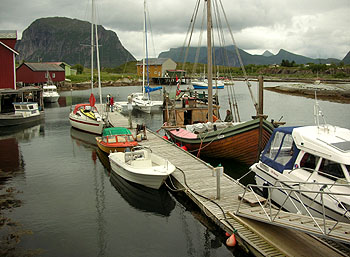
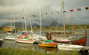
Good sandy bottom and nice anchoring spots all the way up into the harbour basin, on the east side of the main island. You enter the main channel from the north, continue all the way until you reach the jetty and then follow a narrow, marked channel to the backside of the main island.
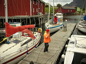
But once you are here, you will most likely prefer to use the guest dock, which has ample capacity and is in close proximity to the general store. Both water and power is available.
Overnight Accommodation/Tenting
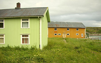
In spite of the fact that you find yourself in our "village centre", you will have no problem finding your own secluded bit of paradise among the old buildings and remnants of earlier times. There are large areas where you can wander, and if you feel the need for even more privacy, you can always paddle over to Helløya Island.)
Water
Here you can fill up just about everywhere. In the houses, at the general store and on the boat docks.
Firewood
Minimal driftwood or dry wood to be found. Base your cooking on a primus/burner only.
Conservation Regulations
Støtt is part of the Støtt Archipelago Nature Reserve of Meløy Municipality. Camping, tenting and travel by land in the reserve area is prohibited during the period from 15 April to 31 July, with the exception of Støtt's main islands (i.e., both Svenningen and Inner Støtt) and Hundholmen.
Walking Options
A boat trip "Round Støtt Archipelago" is a must. A walking tour along the road, across the jetty and the north side of Svenningen is also recommended.
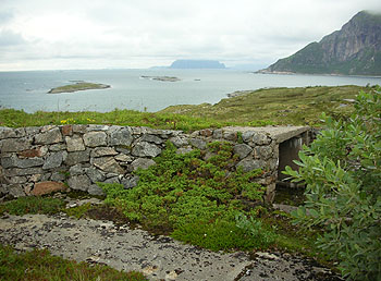
Attractions include the ruins of a German coastal fortress and enjoying the view to the north and west towards Lofoten.
You will find more information about Støtt at Sorensen-Stott.No
|
 Butikk, hurtigbåt-, ferge- og gjestekai ligger på en holme midt i sundet, og tettstedet er bundet sammen med vegfyllinger og en molo mot sør som lukker inne hele havne-bassenget. Folketallet holder seg stabilt, i 2005 var det 47 fastboende. Samme år ble imidlertid skolen foreløpig nedlagt pga. mangel på elever. Men fra vinteren 2007 vil du i stedet kunne møte mellom 400 og 500 rein her ute, siden Støtt ligger innafor Saltfjellet reinbeitedistrikt. (Se også turberetningen
 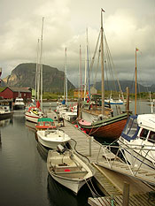 God sandbunn og flotte ankringsplasser helt innerst i havnebassenget, på østsida av holmen. Du kommer inn leia fra nord, fortsetter helt ned til moloen og følger en trang, staka lei til baksida av holmen.
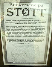 Her kan du fylle over alt. I husan, på butikken, på flyttebrygga.